- Latest Archaeology Updates
- Importance and applicability
- Famous Archaeologists
- Museums Collections
- Site Map
- World Heritage Sites
- World History Monuments
- Archaeological Organizations
- World Atlas of Archaeology
- Forensic Investigation and Geophysics
- Contact Us
- Movies based on Archaeology
- Frequently Asked Questions
- Archaeological discoveries
- Tell a Friend
- Archaeological Abbreviations
- Gallery Collections
- Famous-Museums site map
- Famous-archaeologists site map
- Archaeological Monuments site map
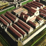
This monument includes the Roman fort identified as Bravoniacum and its associated civilian settlement or vicus.
The fort is located in fields immediately N and E of the Town End of Kirkby Thore and is covered by the modern Main Street.
Whilst the site of the fort has been somewhat denuded by ploughing in the past, the rampart remains visible as a low but distinct terrace.
The line of main street which crosses the fort, changes from its generally straight course to form a slight arc.
This is a strong suggestion that at an early stage of village development a substantial building, perhaps the headquarters building, still stood within the fort and that the road was diverted around its ruins.
The fort is some 2.2 hectares in extent and is believed to have accommodated a cavalry unit.
Numismatic evidence and limited excavation suggests that occupation commenced in the Flavian period with the construction of a turf and timber fort.
This was damaged c.AD 125 and re-built by a masonry-built fort.
Occupation appears to have continued till the late 4th century AD.

